Download
Preview
Add to list
More
44.3 km
~3 days
147 m
Multi-Day
“Explore history and nature on California's scenic Iron Horse Trail, a versatile urban adventure.”
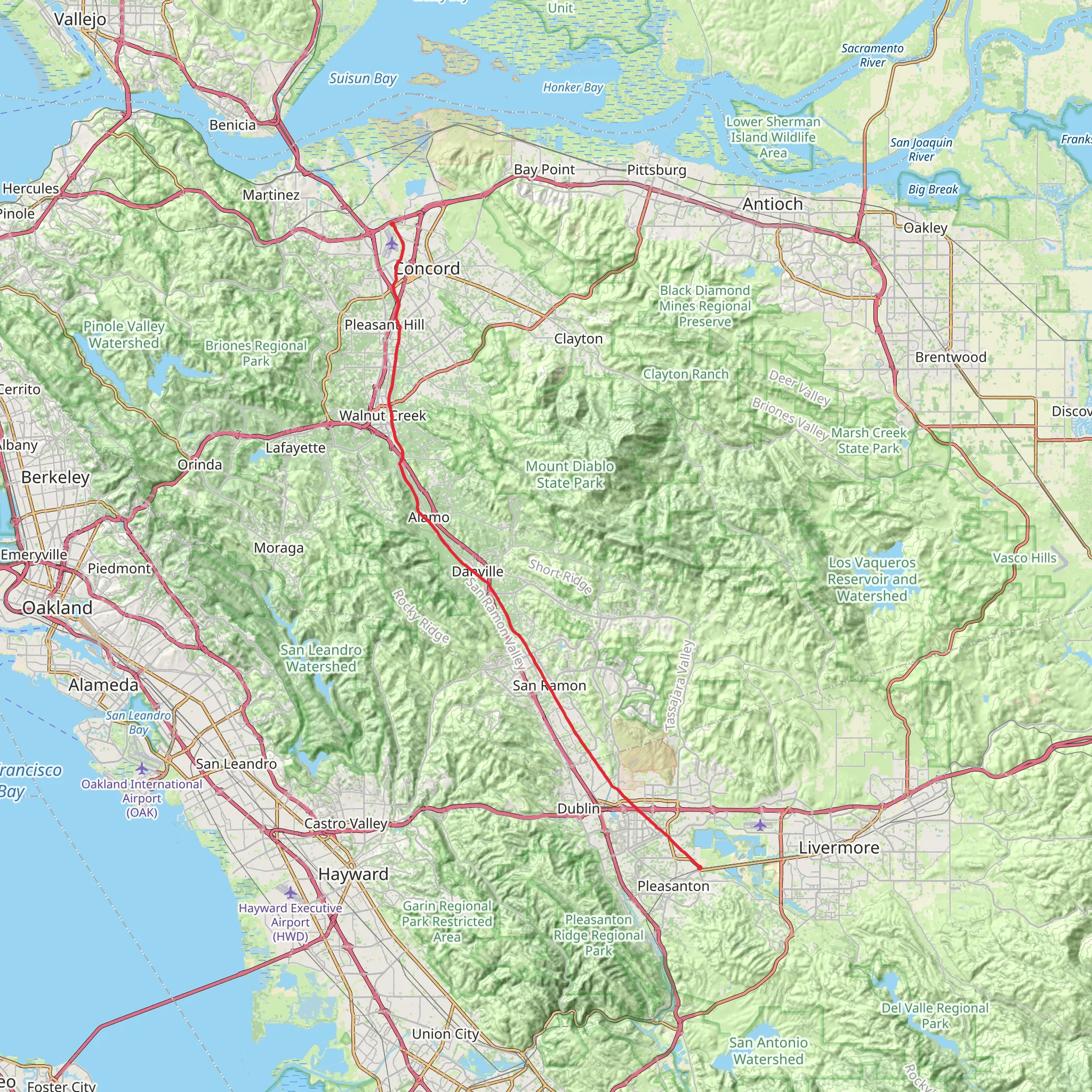
The Iron Horse Trail stretches for approximately 44 kilometers (around 27 miles) and boasts a minimal elevation gain of about 100 meters (328 feet), making it a moderately challenging route that appeals to hikers of various skill levels. The trailhead is conveniently located near Contra Costa County in California, offering a point-to-point journey that traverses through several towns, including Concord, Walnut Creek, and Pleasanton.
Getting to the Trailhead
To reach the starting point of the Iron Horse Trail, hikers can either drive or use public transportation. For those opting to drive, there is parking available near the intersection of Marsh Drive and Solano Way, which is close to the trailhead. Public transportation users can take advantage of the BART (Bay Area Rapid Transit) system, disembarking at the Concord Station, which is a short distance from the trail's commencement.
Trail Experience
As you embark on the Iron Horse Trail, you'll find yourself on a path that follows the former Southern Pacific Railroad right-of-way. This historical aspect adds a layer of intrigue, as the trail was once a bustling railway line that played a significant role in the region's development. The trail is well-maintained and primarily paved, making it accessible for walkers, cyclists, and even equestrians in certain sections.
Landmarks and Surroundings
One of the highlights of the Iron Horse Trail is the variety of urban and natural landscapes it encompasses. The trail meanders through residential areas, commercial districts, and parks, offering a unique blend of environments. Notable landmarks along the route include the Walnut Creek Pedestrian Bridge, which provides a scenic crossing over Ygnacio Valley Road, and the Dublin/Pleasanton BART station, marking the trail's southern terminus.
Nature and Wildlife
Despite its urban proximity, the Iron Horse Trail offers opportunities to enjoy local flora and fauna. The trail is lined with a mix of native and landscaped vegetation, providing greenery and shade. Birdwatchers may spot a variety of species, including hawks and songbirds, while small mammals like squirrels are commonly seen along the route.
Preparation and Planning
Before setting out, hikers should plan their journey with the help of navigation tools like HiiKER, which can assist in mapping the route and identifying key waypoints. It's advisable to carry water, sunscreen, and a hat, especially during warmer months, as some sections of the trail have limited shade. Restrooms and water fountains are available at various points, but it's wise to know their locations in advance.
Historical Significance
The Iron Horse Trail is not only a recreational path but also a corridor rich in history. The Southern Pacific Railroad, which the trail follows, was integral to the area's growth in the late 19th and early 20th centuries, transporting goods and passengers throughout the region. Today, the trail serves as a reminder of the past while providing a modern-day asset for community connectivity and outdoor activities.
Whether you're looking for a leisurely walk, a vigorous bike ride, or a historical journey through Contra Costa County, the Iron Horse Trail offers a diverse experience for all who traverse its path.
What to expect?
Comments and Reviews
User comments, reviews and discussions about the Iron Horse Trail, California.
4.5
average rating out of 5
4 rating(s)

