Download
Preview
Add to list
More
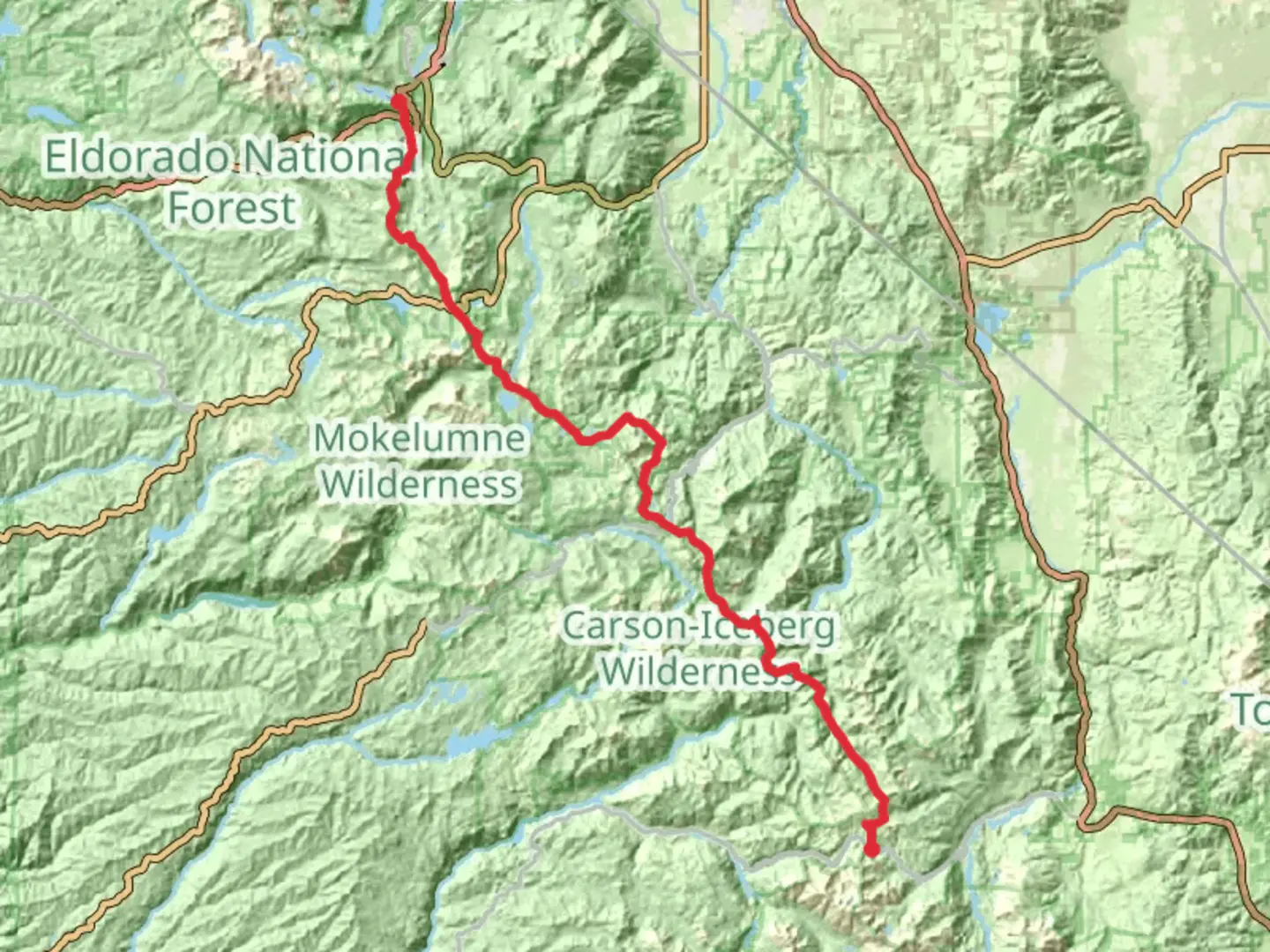
118.4 km
~29 hrs 3 min
3235 m
Point-to-Point
“Embark on a breathtaking trek through diverse landscapes and historical wonders in the Sierra Nevada.”
Starting your journey near Alpine County, California, the Pacific Crest National Scenic Trail from Sonora Pass offers an exhilarating adventure through some of the most stunning landscapes in the Sierra Nevada. This point-to-point trail stretches approximately 118 kilometers (about 73 miles) and features an elevation gain of around 3,200 meters (10,500 feet), making it a challenging yet rewarding trek for those seeking a medium-difficulty hike.
Getting There
To reach the trailhead near Sonora Pass, you can drive via Highway 108, which is accessible from both the east and west. If you're coming from the west, the nearest major city is Modesto, California, about a 2.5-hour drive. From the east, Reno, Nevada, is approximately a 2-hour drive. Public transportation options are limited, so driving is the most convenient way to access the trailhead. Parking is available near the pass, but it's advisable to arrive early, especially during peak hiking seasons.
Trail Highlights and Landmarks
As you embark on this journey, you'll traverse a diverse range of ecosystems, from lush meadows to rugged alpine terrain. The trail offers breathtaking views of the Sierra Nevada mountains, with peaks often dusted with snow even in the summer months. One of the most notable landmarks along the trail is the Emigrant Wilderness, a pristine area known for its granite ridges, clear lakes, and abundant wildlife. Keep an eye out for mule deer, black bears, and a variety of bird species that inhabit this region.
Historical Significance
The area surrounding Sonora Pass is steeped in history. During the California Gold Rush in the mid-1800s, this region was a bustling route for miners seeking fortune. The remnants of old mining camps and trails can still be found, offering a glimpse into the past. The Pacific Crest Trail itself is part of a larger network of trails that have been used by Native American tribes for centuries, adding a layer of cultural significance to your hike.
Navigation and Safety
Navigating the Pacific Crest Trail requires careful planning. While the trail is well-marked, it's essential to have a reliable navigation tool. The HiiKER app is highly recommended for its detailed maps and real-time updates. Weather conditions can change rapidly in the Sierra Nevada, so be prepared for sudden temperature drops and potential thunderstorms, especially at higher elevations.
Trail Sections and Elevation
The trail is divided into several sections, each offering unique challenges and rewards. The initial ascent from Sonora Pass is steep, gaining significant elevation over the first few kilometers. As you progress, the trail undulates through a series of ridges and valleys, providing both strenuous climbs and gentle descents. The highest point along this section of the Pacific Crest Trail is near Leavitt Peak, where you'll be rewarded with panoramic views of the surrounding wilderness.
Wildlife and Flora
The diverse ecosystems along the trail support a rich variety of flora and fauna. In the lower elevations, you'll encounter dense forests of pine and fir, while higher up, the landscape transitions to alpine meadows dotted with wildflowers. This area is also home to several species of reptiles and amphibians, so tread carefully and respect the natural habitat.
Final Preparations
Before setting out, ensure you have all necessary permits and are aware of any fire restrictions or trail closures. Water sources can be scarce in certain sections, so plan your water resupply points carefully. With the right preparation, hiking the Pacific Crest National Scenic Trail from Sonora Pass promises an unforgettable adventure through one of California's most beautiful and historically rich regions.

What to expect?
Activity types
Comments and Reviews
User comments, reviews and discussions about the Pacific Crest National Scenic Trail - 2000 from Sonora Pass, California.
average rating out of 5
0 rating(s)