Download
Preview
Add to list
More
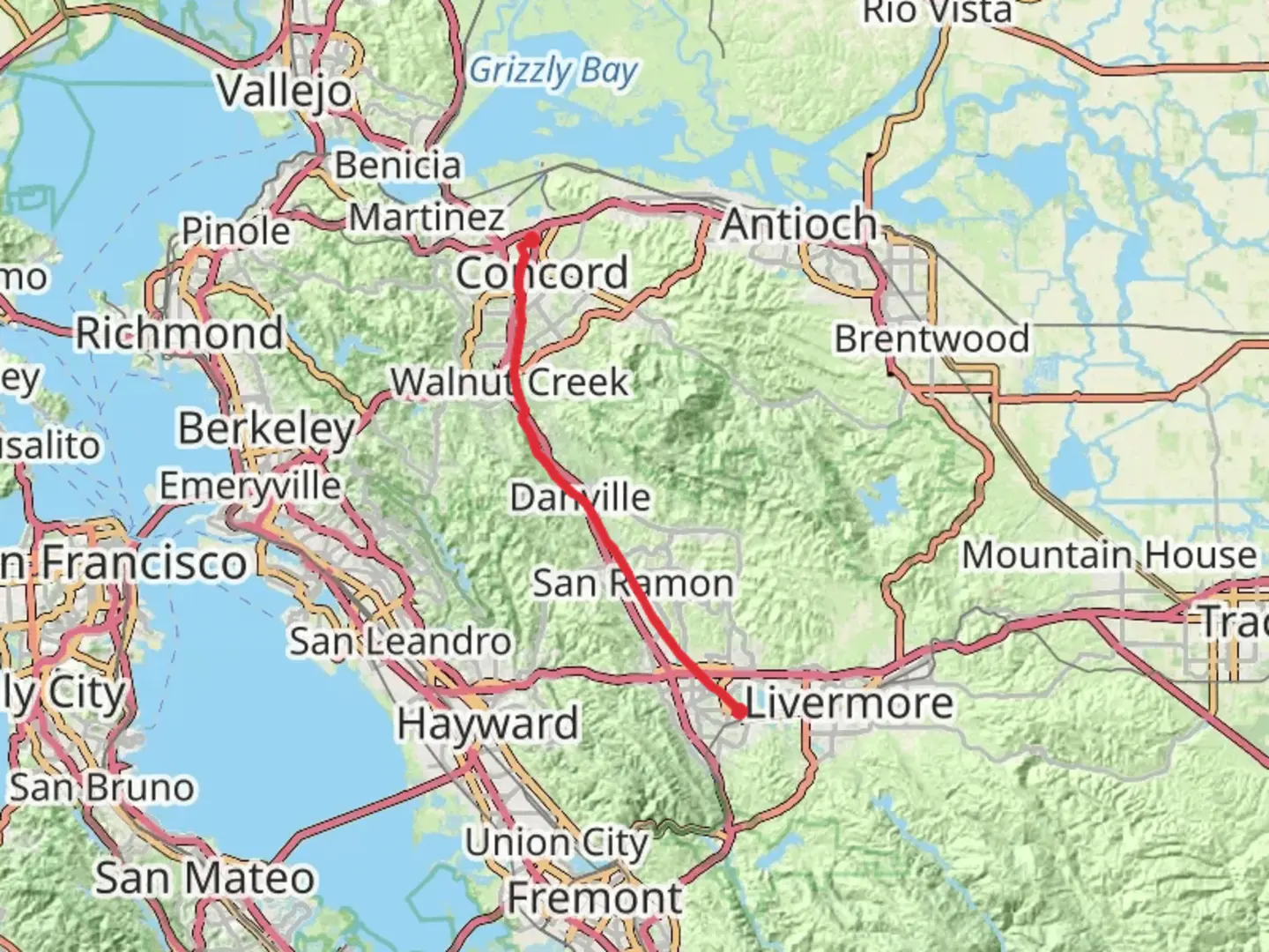
44.8 km
~9 hrs 5 min
82 m
Point-to-Point
“The Iron Horse Trail offers a scenic, leisurely journey through history, nature, and charming towns.”
The Iron Horse Trail stretches approximately 45 kilometers (about 28 miles) through the scenic landscapes of Alameda County, California. This point-to-point trail is renowned for its easy difficulty level, making it accessible to hikers of all skill levels. With virtually no elevation gain, the trail is perfect for those seeking a leisurely walk or a long-distance cycling adventure.
Getting There
The trailhead is conveniently located near the city of Pleasanton in Alameda County. If you're driving, you can park at the Pleasanton BART Station, which is a well-known starting point. For those using public transport, the Bay Area Rapid Transit (BART) system provides easy access to the trailhead. Simply take the BART to the Pleasanton station, and you'll find the trail entrance nearby.
Trail Highlights
The Iron Horse Trail follows the path of a former railway line, offering a unique blend of urban and natural landscapes. As you traverse the trail, you'll pass through several charming towns, including Dublin, San Ramon, and Danville. Each town offers its own unique attractions, from quaint cafes to local shops, providing perfect spots for a rest or a quick bite.
Nature and Wildlife
Despite its urban proximity, the trail is lined with lush greenery and offers glimpses of local wildlife. Keep an eye out for native birds and small mammals that inhabit the area. The trail is particularly beautiful in spring when wildflowers bloom along the path, adding vibrant colors to your journey.
Historical Significance
The Iron Horse Trail is steeped in history, tracing the route of the Southern Pacific Railroad's San Ramon Branch Line. This railway was instrumental in the development of the region during the late 19th and early 20th centuries. As you walk, you'll encounter interpretive signs that provide insights into the area's rich history, including its role in the transportation of goods and passengers.
Navigation and Safety
For navigation, the HiiKER app is an excellent tool to help you stay on track and explore nearby points of interest. The trail is well-marked and maintained, but it's always wise to carry a map or digital guide. Since the trail is mostly flat, it's suitable for families and those looking for a relaxed outdoor experience. However, be mindful of cyclists and other trail users, especially in more populated sections.
Whether you're a local resident or a visitor to the Bay Area, the Iron Horse Trail offers a delightful escape into nature with a touch of historical charm.

What to expect?
Activity types
Comments and Reviews
User comments, reviews and discussions about the Iron Horse Trail, California.
average rating out of 5
0 rating(s)