Download
Preview
Add to list
More
49.0 km
~2 day
696 m
Point-to-Point
“Embark on a captivating desert trek through diverse landscapes, rich history, and vibrant wildlife.”
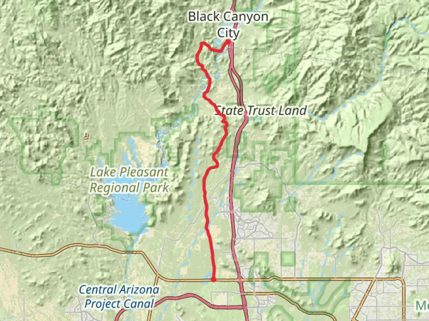
Starting your journey near Yavapai County, Arizona, the Maricopa Trail - Black Canyon Trail offers a captivating 49 km (approximately 30 miles) trek through the diverse landscapes of the Sonoran Desert. With an elevation gain of around 600 meters (about 1,970 feet), this point-to-point trail is rated as medium difficulty, making it suitable for hikers with some experience.
Getting There
To reach the trailhead, you can drive or use public transportation. If driving, head towards the vicinity of Yavapai County, Arizona. The nearest significant landmark to the trailhead is the Black Canyon City, which is accessible via Interstate 17. For those relying on public transport, buses run from Phoenix to Black Canyon City, where you can arrange for a local taxi or rideshare to the trailhead.
Trail Highlights
#### Scenic Landscapes
As you embark on this trail, you'll traverse through the stunning Sonoran Desert, renowned for its unique flora and fauna. The trail offers expansive views of the surrounding mountains and valleys, with the Bradshaw Mountains providing a dramatic backdrop. Keep an eye out for the iconic saguaro cacti, which stand tall against the desert skyline.
#### Wildlife and Nature
The trail is home to a variety of wildlife, including mule deer, javelinas, and a diverse array of bird species. Birdwatchers will delight in spotting species such as the Gila woodpecker and the cactus wren. The desert environment also supports a range of reptiles, so be mindful of your surroundings and watch for snakes basking in the sun.
Historical Significance
The region around the Maricopa Trail - Black Canyon Trail is steeped in history. The Black Canyon area was once a significant route for Native American tribes and later became a path for early settlers and miners. As you hike, you'll be walking in the footsteps of those who traversed this land long before modern trails were established.
Navigation and Safety
Given the trail's length and the desert environment, it's crucial to be well-prepared. Use the HiiKER app for accurate navigation and to stay on track. Ensure you carry sufficient water, as the desert heat can be intense, especially during the summer months. It's advisable to start your hike early in the morning to avoid the midday sun.
Trail Sections and Elevation
The trail is divided into several sections, each offering its own unique challenges and rewards. The initial part of the trail is relatively flat, allowing you to ease into the hike. As you progress, the elevation gradually increases, with the most significant climbs occurring around the mid-point of the trail. This section offers panoramic views that make the effort worthwhile.
Final Stretch
As you near the end of the trail, the descent begins, leading you back down towards the valley floor. The final stretch offers a gentle walk, allowing you to reflect on the journey and the natural beauty you've experienced. The trail concludes near the Agua Fria River, a serene spot to rest and enjoy the tranquility of the desert landscape.

What to expect?
Activity types
Comments and Reviews
User comments, reviews and discussions about the Maricopa Trail - Black Canyon Trail, Arizona.
average rating out of 5
0 rating(s)