Download
Preview
Add to list
More
19.9 km
~2 days
1613 m
Multi-Day
Oracle Ridge Trail
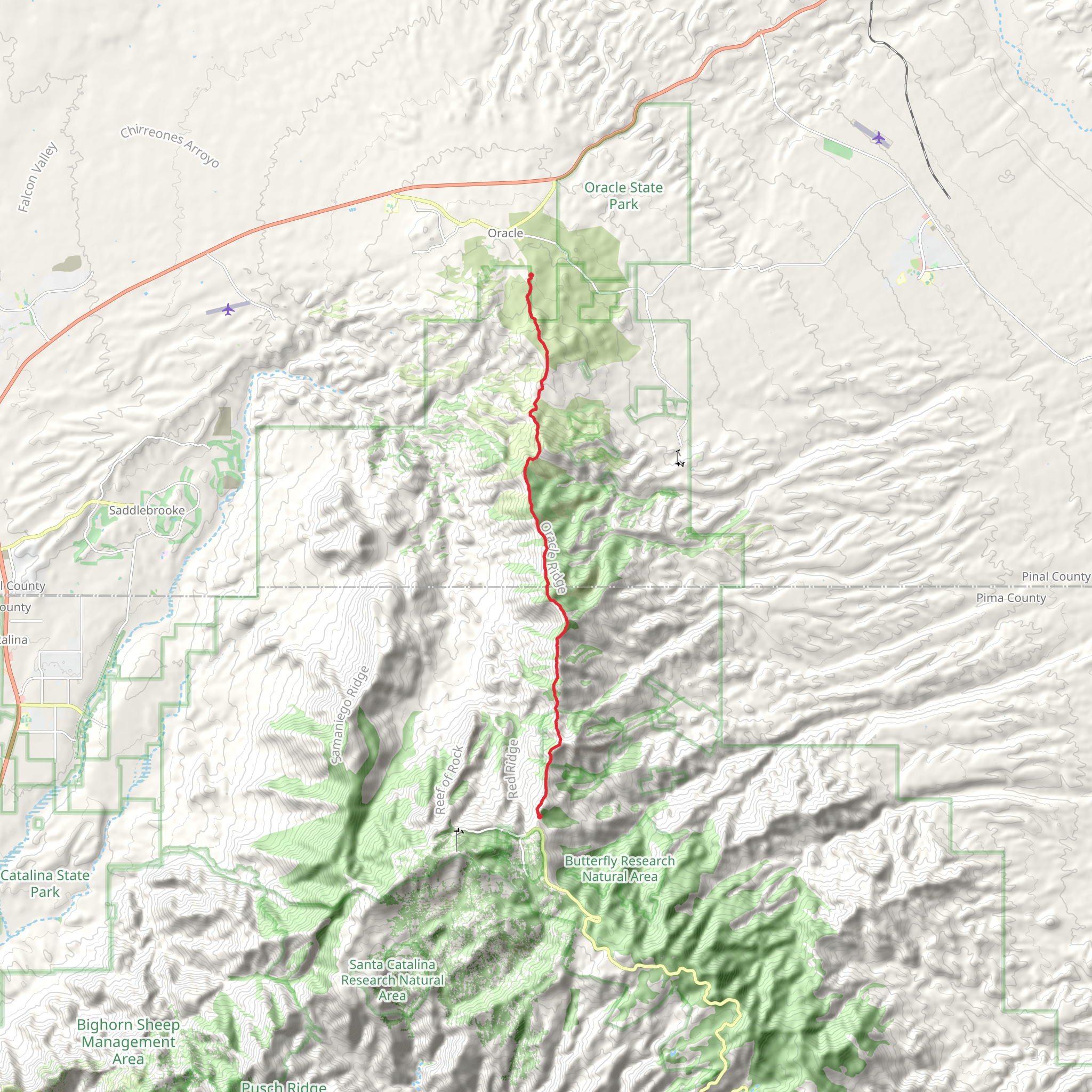
Oracle Ridge Trail is a scenic and challenging point-to-point hike located near Pinal County, Arizona. Spanning approximately 20 kilometers (12.4 miles), this trail offers an elevation gain of around 1600 meters (5250 feet), which provides a medium difficulty rating for those looking to explore the area.
Getting to the Trailhead
The trailhead for Oracle Ridge Trail is accessible by car. To reach the starting point, you'll want to drive to the vicinity of Oracle, AZ. From Tucson, take AZ-77 N/Oracle Road towards the town of Oracle. Once in Oracle, follow the signs that lead towards the Mount Lemmon area. The trailhead is located off of Control Road, which is a turnoff from Mount Lemmon Road. There is a parking area where you can leave your vehicle before beginning your hike.
Trail Experience
As you embark on the Oracle Ridge Trail, you'll be greeted with a variety of landscapes, including lush forested areas, open ridgelines, and rocky outcrops. The trail is well-marked, but it's always wise to have a reliable navigation tool like HiiKER to ensure you stay on the correct path.
The first few kilometers will challenge you with a series of switchbacks as you begin your ascent. The vegetation here is a mix of oak, juniper, and manzanita, with the occasional ponderosa pine offering shade. Wildlife is abundant, with chances to spot deer, javelina, and a variety of bird species, so keep your camera ready and your distance respectful.
As you continue, the trail becomes rockier and the incline increases. The views start to open up, offering breathtaking vistas of the San Pedro River Valley and the Galiuro Mountains in the distance. Around the halfway mark, you'll reach the trail's highest point, which is a perfect spot to take a break and enjoy the panoramic views.
Historical Significance
The Oracle Ridge Trail is not only a journey through nature but also through history. The area is known for its mining past, and along the trail, you'll encounter remnants of this era, including old mine shafts and equipment. These relics serve as a reminder of the region's rich history and the hardworking people who once sought fortune in these mountains.
Flora and Fauna
The diverse elevation changes along the trail support a variety of plant life, from high desert cacti to alpine fir. Springtime hikers will be rewarded with a colorful display of wildflowers. The trail is also home to a range of wildlife, including black bears, so it's important to be bear aware and practice safe food storage and disposal.
Preparation and Safety
Before setting out on the Oracle Ridge Trail, ensure you are well-prepared with adequate water, sun protection, and layers of clothing to accommodate the changing temperatures at different elevations. The trail can be rocky and steep in places, so sturdy hiking boots are recommended. Always let someone know your hiking plans and expected return time.
Remember, the Oracle Ridge Trail is a point-to-point hike, so you'll need to arrange transportation back to your starting point or leave a second vehicle at the trail's end. The end of the trail is near the community of Summerhaven, where you can find refreshments and celebrate the completion of your hike.
Comments and Reviews
User comments, reviews and discussions about the Oracle Ridge Trail, Arizona.
5.0
average rating out of 5
3 rating(s)

