Download
Preview
Add to list
More
47.5 km
~13 hrs 15 min
2258 m
Loop
“Trek the Romero Canyon loop for a scenic, history-rich hike through Arizona's diverse terrains.”
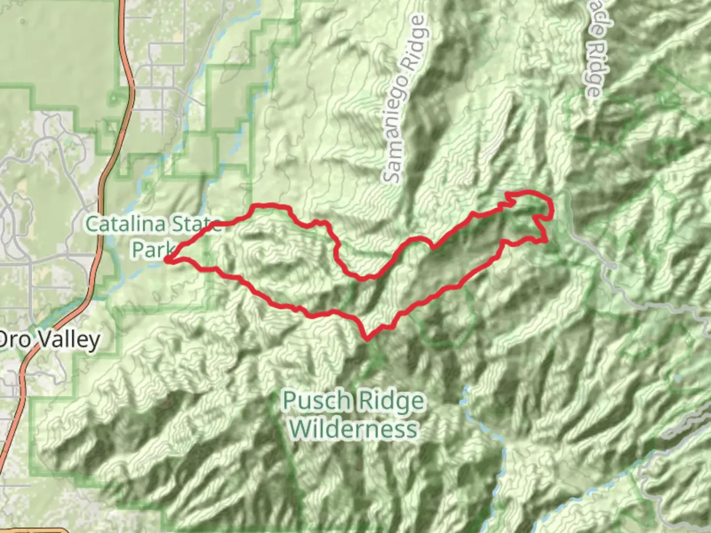
Embarking on the Romero Canyon, Mount Lemmon and Cargodera Canyon Loop Trail, hikers will traverse a diverse landscape that spans approximately 48 kilometers (about 30 miles) with an elevation gain of roughly 2200 meters (around 7200 feet). This loop trail, nestled near Pima County, Arizona, is rated as medium difficulty, offering a challenging yet rewarding experience for those with some hiking experience.
Getting to the Trailhead
To reach the trailhead, if you're driving, head towards Catalina State Park, located on North Oracle Road, just north of Tucson. The park serves as the gateway to the Coronado National Forest, where the trail begins. For those opting for public transportation, take a bus to the Catalina Highway and arrange for a taxi or a ride-share service to take you to the park's entrance.
Romero Canyon Section
The journey begins in the lush surroundings of Romero Canyon. As you ascend, the trail offers a mix of terrains, including rocky paths and stream crossings, especially during the wetter seasons. The first section of the trail is a gradual climb, with the sounds of running water from Romero Creek accompanying you as you make your way through the canyon.
Mount Lemmon Ascent
As you continue, the trail becomes steeper, leading towards Mount Lemmon, the highest peak in the Santa Catalina Mountains. The ascent is a test of endurance, but the changing scenery provides a distraction, with saguaro cacti giving way to pine and aspen forests. The air cools as you gain elevation, and the panoramic views of the surrounding desert landscape become more impressive.
Cargodera Canyon Descent
After reaching the peak, the trail descends into Cargodera Canyon. This portion is less traveled and offers a sense of solitude. The descent is steep in places, so careful footing is necessary. The canyon is home to a variety of wildlife, including deer, javelinas, and various bird species, so keep your eyes peeled and your camera ready.
Historical Significance
The region is rich in history, with the Santa Catalina Mountains having been home to indigenous peoples for thousands of years. The area was also significant during the mining boom in the late 19th and early 20th centuries, and hikers may come across old mine shafts and remnants of this bygone era.
Flora and Fauna
Throughout the hike, the diverse ecosystems are home to a wide array of plant and animal life. From the iconic saguaro cactus to the rare Ponderosa pine, the trail offers a chance to see the adaptability of flora in the desert environment. Wildlife sightings might include the Gila monster, Mexican spotted owl, and if you're lucky, the elusive mountain lion.
Navigation and Preparation
Given the trail's length and elevation changes, it is essential to be well-prepared with adequate water, food, and clothing for changing weather conditions. Using the HiiKER app can help with navigation, ensuring you stay on the correct path and can track your progress throughout the hike.
Final Ascent and Return
The final leg of the loop brings you back towards the trailhead, with a gentle ascent through a recovering burn area, showcasing nature's resilience. The loop closes as you descend back into the canyon, completing a circuit full of natural beauty and a sense of accomplishment.

What to expect?
Activity types
Comments and Reviews
User comments, reviews and discussions about the Romero Canyon, Mount Lemmon and Cargodera Canyon Loop Trail, Arizona.
average rating out of 5
0 rating(s)