Second Water Trail and Hackberry Spring Loop Trail
6.9 km
~1 hrs 41 min
197 m
“Embark on Arizona's historic Second Water Trail to Hackberry Spring, where desert vistas meet a serene oasis.”
The Second Water Trail and Hackberry Spring Loop is a moderately challenging hike located near Maricopa County, Arizona, offering a blend of desert landscapes, historical significance, and the chance to spot local wildlife. The loop covers approximately 7 kilometers (about 4.3 miles) with an elevation gain of around 100 meters (328 feet), providing a good workout without being too strenuous for those with some hiking experience.
Getting to the Trailhead To reach the trailhead, you can drive to the First Water Trailhead, which is the starting point for several hikes within the Superstition Wilderness. From the Phoenix area, take US-60 E and exit on Apache Junction, following signs for AZ-88 E/N Apache Trail. Continue on AZ-88 E for about 8 miles until you reach the First Water Trailhead on the right side of the road. There is no direct public transportation to the trailhead, so a personal vehicle or taxi service is necessary.
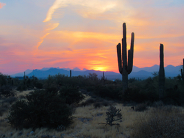
Navigating the Trail Once at the trailhead, you'll begin on the Second Water Trail, marked as Trail #236. The path is well-defined and meanders through the typical Sonoran Desert landscape dotted with saguaro cacti, cholla, and mesquite. Hikers can use the HiiKER app to navigate the trail and ensure they stay on the correct path.
Historical Significance and Landmarks The Superstition Wilderness is steeped in legends and history, most notably the fabled Lost Dutchman's Gold Mine. As you hike, imagine the countless prospectors who traversed these trails in search of fortune. The area is also rich in Native American history, with the trail passing near ancient petroglyphs and remnants of old trails used by the Apache tribe.
Wildlife and Nature Keep an eye out for the diverse wildlife that inhabits the area, including jackrabbits, coyotes, and a variety of bird species. The springtime brings a colorful display of wildflowers, adding to the trail's beauty. Hackberry Spring, a reliable water source, is a highlight of the hike and a good spot to rest and enjoy the sound of trickling water—a rarity in the desert.
Trail Experience The trail gradually ascends to Garden Valley, a flat area that contrasts with the surrounding rugged terrain. From here, you'll connect to the Hackberry Spring Loop, which will lead you to the spring itself. The loop then circles back to join the Second Water Trail, completing the circuit. The elevation gain is spread out, making the inclines manageable.
Preparation and Safety Due to the desert environment, it's essential to carry plenty of water—at least one gallon per person—and to wear sun protection, including a hat and sunscreen. The best times to hike are in the cooler months from November to April. Always check the weather before heading out, as flash floods can occur during the monsoon season.
Remember, while the Second Water Trail and Hackberry Spring Loop Trail offers a glimpse into the rugged beauty of the Arizona desert, it's crucial to be prepared and respect the natural environment to ensure a safe and enjoyable hiking experience.
Reviews
User comments, reviews and discussions about the Second Water Trail and Hackberry Spring Loop Trail, Arizona.
4.0
average rating out of 5
13 rating(s)


