Download
Preview
Add to list
More
21.0 km
~2 days
216 m
Multi-Day
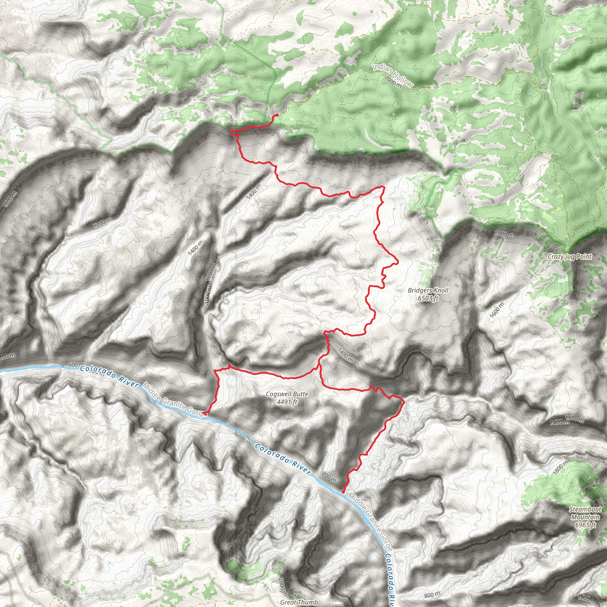
The Thunder River Trail to Deer Creek Trail is a captivating journey through the heart of the Grand Canyon, offering hikers a unique blend of desert landscapes, riparian ecosystems, and stunning geological formations. This approximately 21 km (13 miles) point-to-point trail begins near Coconino County, Arizona, and is considered to have a medium difficulty rating due to its terrain and elevation gain of around 200 meters (656 feet).
Getting to the Trailhead
Access to the Thunder River Trailhead is typically achieved by driving or taking a shuttle to the North Rim of the Grand Canyon. The closest significant landmark is the North Rim Visitor Center, from which you would drive on the North Rim Parkway (Highway 67) to the end of the road. Here, you'll find the Bill Hall Trail parking area, which serves as the starting point for your hike. For those relying on public transport, options are limited, and it's often necessary to arrange for a shuttle service from nearby towns such as Kanab, Utah, or Page, Arizona.
Navigating the Trail
As you embark on your hike, it's essential to have a reliable navigation tool like HiiKER to guide you along the trail. The path descends steeply from the North Rim, taking you through a series of switchbacks before leveling out as you approach Thunder River. This is where you'll witness the remarkable sight of a river bursting forth from the side of a cliff, a rare desert spring that is one of the trail's highlights.
Continuing on, the trail meanders alongside Thunder River, offering a lush contrast to the surrounding arid environment. The convergence of Thunder River and Tapeats Creek is a notable landmark, where the clear waters provide a serene spot to rest and enjoy the scenery.
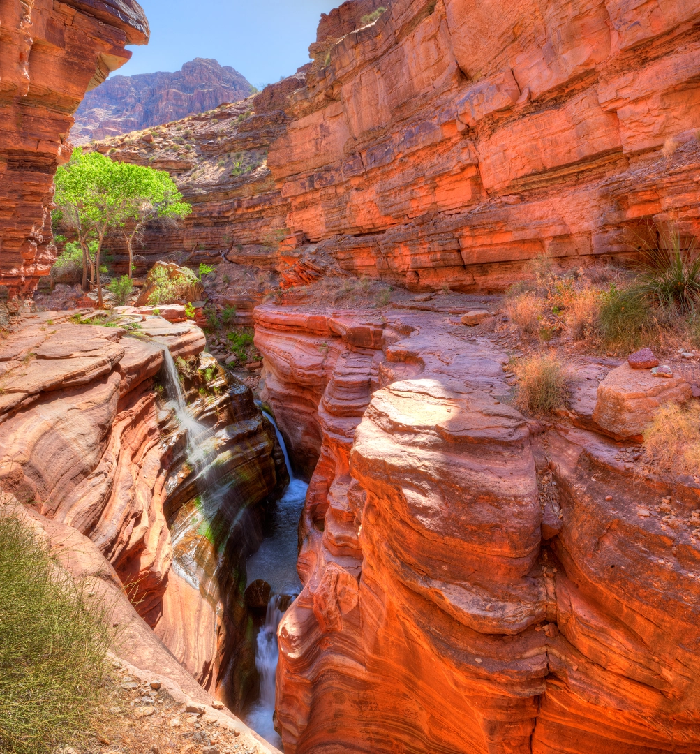
As you progress towards Deer Creek, the trail becomes more rugged, with narrow sections that skirt the edges of steep drop-offs. Caution is advised in these areas, especially for those with a fear of heights. The trail's descent into the Deer Creek area presents another dramatic scene as Deer Creek cascades through a slot canyon before plunging over Deer Creek Falls into the Colorado River.
Flora and Fauna
The diverse ecosystems along the trail support a variety of plant and animal life. You may encounter species such as the California condor, bighorn sheep, and various reptiles. The riparian areas around Thunder River and Deer Creek are lush with vegetation, including cottonwoods, willows, and wildflowers, providing a stark contrast to the surrounding desert.
Historical Significance
The Grand Canyon region is rich in history, with the trail passing through land that has been home to Native American tribes for thousands of years. The area is dotted with archaeological sites, and the presence of ancient petroglyphs and dwellings is a testament to the canyon's long-standing significance to human culture.
Preparation and Planning
Due to the remote nature of the trail and the extreme weather conditions that can occur in the Grand Canyon, it is crucial to be well-prepared. Ensure you have plenty of water, as sources along the trail are limited and subject to seasonal availability. Additionally, be prepared for sudden weather changes and check for any trail advisories or closures before your hike.
In conclusion, the Thunder River Trail to Deer Creek Trail is a challenging yet rewarding experience that showcases the Grand Canyon's unique beauty. With careful planning and respect for the natural environment, hikers can enjoy a memorable adventure through one of the world's most iconic landscapes.
What to expect?
Activity types
Comments and Reviews
User comments, reviews and discussions about the Thunder River Trail to Deer Creek Trail, Arizona.
4.67
average rating out of 5
9 rating(s)

