Download
Preview
Add to list
More
32.1 km
~3 days
1468 m
Multi-Day
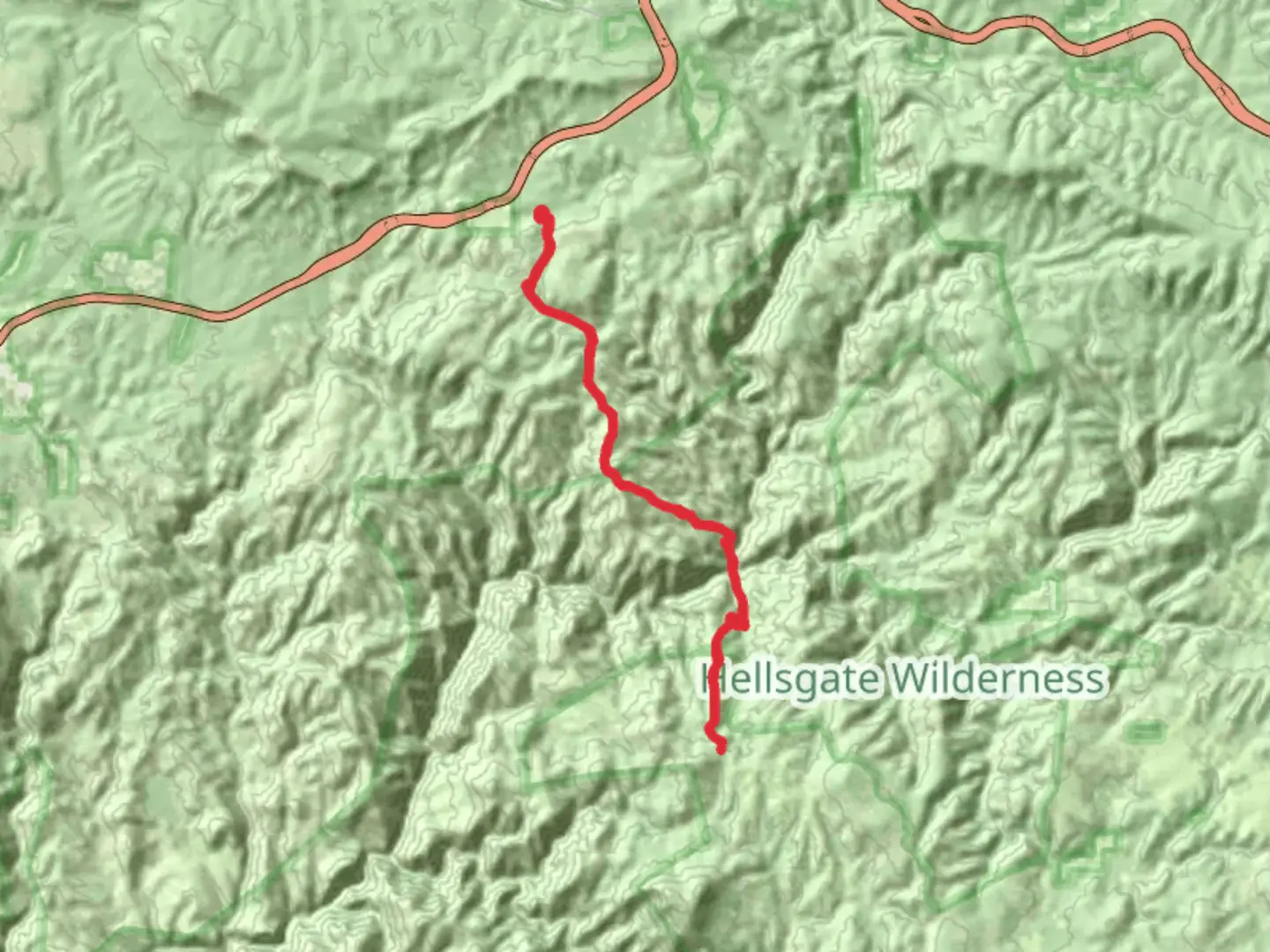
Hells Gate TrailThe Hells Gate Trail is a challenging yet rewarding trek nestled in the rugged terrain near Gila County, Arizona. Spanning approximately 32 kilometers (about 20 miles) and featuring an elevation gain of around 1400 meters (approximately 4600 feet), this out-and-back trail offers a medium difficulty rating, making it accessible to hikers with a reasonable level of fitness and experience.Getting to the TrailheadThe trailhead for Hells Gate Trail is located off Forest Road 405A, which is accessible by car. To reach the starting point, hikers should take Highway 260 to Forest Road 405 (Tonto Creek Road), then continue to Forest Road 405A, where they will find the designated parking area. There is no direct public transportation to the trailhead, so a personal vehicle or a taxi service is required.Trail DescriptionAs you embark on the Hells Gate Trail, you'll traverse through diverse landscapes, including high desert scrub and riparian zones. The trail begins with a descent into the Tonto Basin, offering panoramic views of the surrounding mountains. The path is well-defined, but hikers should be prepared for loose rocks and uneven terrain.Approximately 8 kilometers (5 miles) into the hike, you'll encounter the confluence of Tonto Creek and Haigler Creek, which is a highlight of the trail. This area, known as Hell's Gate, is a popular spot for a rest or a swim in the warmer months. The striking rock formations and the flowing waters create a picturesque setting that is well worth the hike.Flora and FaunaThroughout the journey, hikers will be treated to a variety of plant and animal life. The trail is home to a range of vegetation, from cacti and agave to sycamore and cottonwood trees. Wildlife sightings may include mule deer, javelina, and a variety of bird species. Caution is advised as the area is also inhabited by rattlesnakes and other wildlife that hikers should observe from a safe distance.Historical SignificanceThe region around Hells Gate Trail is steeped in history. The Tonto Basin was once the homeland of the Apache and Yavapai peoples, and later became a site of conflict during the Apache Wars. Hikers walking these paths tread on lands that hold centuries of stories and cultural significance.NavigationTo navigate the trail, hikers are encouraged to use the HiiKER app, which provides detailed maps and GPS coordinates to ensure you stay on the correct path. It's important to download the trail map prior to departure, as cell service can be spotty in remote areas.Preparation and SafetyDue to the trail's length and elevation gain, it's essential to be well-prepared. Hikers should bring plenty of water—at least 4 liters per person—as there are limited sources along the route, especially during dry seasons. Additionally, pack high-energy snacks and a first-aid kit. Sturdy hiking boots are recommended to navigate the rocky and sometimes steep terrain.Start early to avoid the midday heat and to ensure enough daylight to complete the hike. Always let someone know your plans and expected return time. Weather conditions can change rapidly, so check the forecast and be prepared for varying temperatures.ConclusionThe Hells Gate Trail is a journey through Arizona's rugged beauty, offering a glimpse into the area's rich natural and historical tapestry. With proper preparation and respect for the environment, hikers can enjoy a memorable experience in the heart of the Tonto National Forest.

Comments and Reviews
User comments, reviews and discussions about the Hells Gate Trail, Arizona.
4.67
average rating out of 5
3 rating(s)